Slavnostní zahájení významného investičního projektu – „Kalové hospodářství ČOV Brno – Modřice“
Mathematical modelling
AQUATIS a.s. is a company with a long tradition in mathematical modelling in the field of water management. As part of our services, we offer 1D, 2D, combined 1D+2D and 3D models.
These are most often the following:
• hydrodynamic modelling,
• rainfall-runoff modelling,
• erosion process modelling,
• water quality modelling
We use SW MIKE+ for 1D flow simulations This interface provides the possibility to use features of the ArcGIS software both in terms of underlying data and output presentation.
It is used for the following activities:
• Comprehensive solution to urban drainage and water supply concepts.
• Calibration and verification of mathematical models of sewerage and water supply systems based on measured data.
• Identification of hotspots based on a comparison of monitoring data and mathematical model output data.
• Comprehensive solution to urban drainage and water supply concepts.
• Calibration and verification of mathematical models of sewerage and water supply systems based on measured data.
• Identification of hotspots based on a comparison of monitoring data and mathematical model output data.
Outputs from the 1D models can be used as a basis for subsequent simulations using 2D and 3D models.
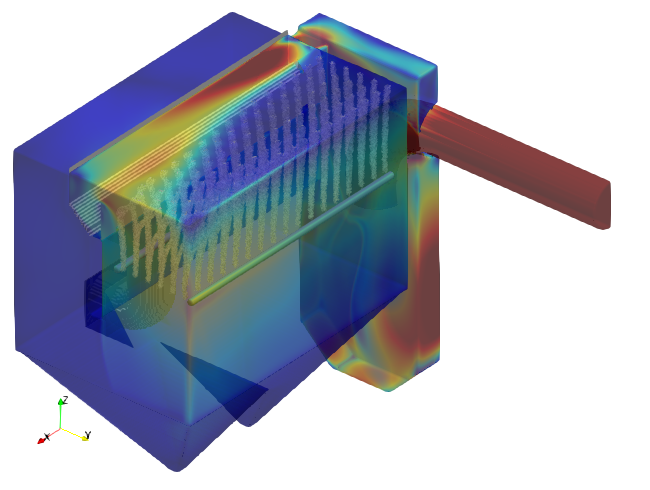
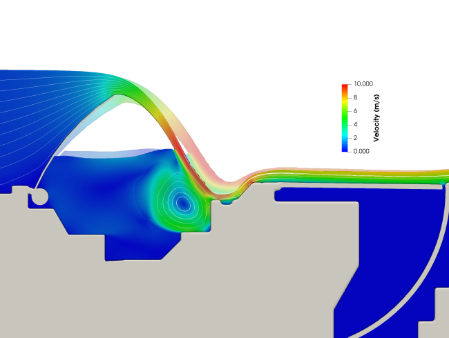
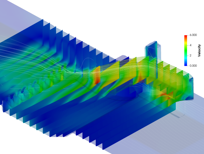
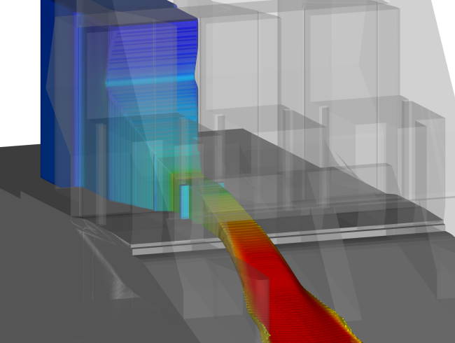
For 3D flow simulations we use commercial software FLOW-3D, with its strong feature being free surface flow solution. The 3D flow modelling can be used in water management for a wide range of applications:
• hydraulic engineering – design/assessment/optimization of safety overflows, chutes, stilling ponds and inflows to hydroelectric power plants.
• WWTP – flows in WWTP facilities with efficiency evaluation (sand traps, primary/secondary clarifiers), sludge mixing in storage tanks and digesters;
• water industry – sedimentation tank flows, water chlorination, hydraulic mixing of chemicals;
• sewerage – design/assessment of combined system overflows, well holes, flow split chambers;
• water quality – thermal/mass load spreading in river systems or in water reservoirs.
The results of rainfall-runoff modelling can serve as inputs to hydrodynamic models, or they can also be applied independently in specialized studies. The rainfall-runoff models are divided according to the time aspect into the so-called “episodic” (these are single clearly limited events, such as a run-off response of an area to a heavy rain event) and “water balance” models (covering longer periods where the interest is focused on the evolution of monitored quantities over time and
their mutual relations). Another method of distinguishing between the rainfall-runoff models is, for example, based on the spatial level of detail. Previously, the concept of the so-called “holistic” model prevailed. This model addresses the entire area using a single set of parameters. According to this approach, the entire area of interest is affected by the same rainfall. There are also more complex concepts. Distributed models are characterized by a unique set of parameters in each spatial cell, which makes it possible to obtain very detailed spatial information. On the other hand, it is necessary to considered to what extent such a detailed result is credible given uncertainties of the inputs.
AQUATIS is part of the SAFICHEM GROUP. A team of experienced specialists, state-of-the-art working tools and thousands of completed projects are a guarantee for the realization of top projects both at home and abroad.
Navigation
News
Contacts
-
- Address
- Botanická 834/56, 602 00 Brno
-
- Mobile
-
- info@aquatis.cz